


About this print
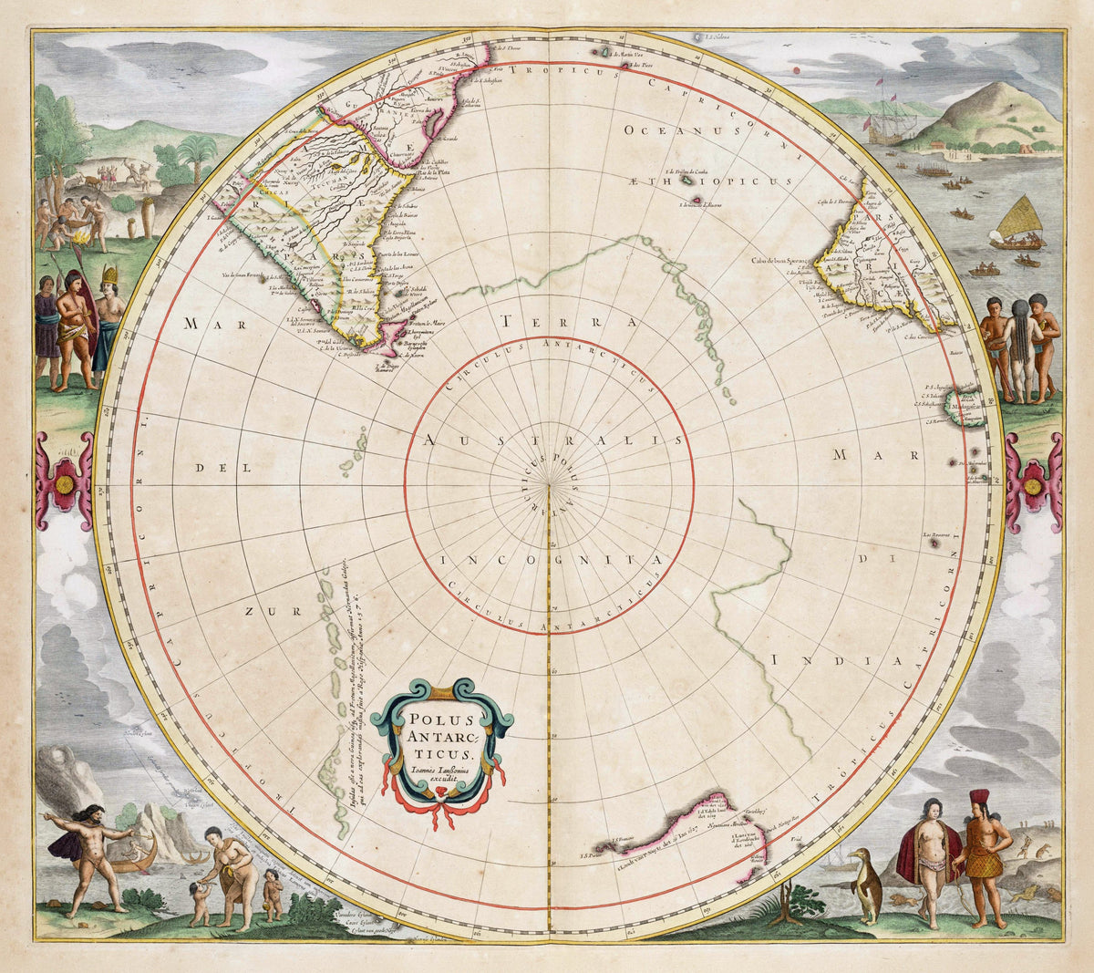
Polus Antarcticus — Jan Jansson, Amsterdam, 1657 state (plate first issued by Hondius, 1637).
The southern tips of the continents around an empty centre, with the first Dutch sightings of Australia's coasts and Tasman's discoveries drawn in.
In the 1650s the far south was still largely guesswork. Mapmakers drew a great southern land, Terra Australis Incognita, around the pole; Abel Tasman's voyage of 1642–43 had sailed right round Australia without sighting it, showing it was not part of any such continent. No one would see Antarctica itself until late January 1820, when Fabian von Bellingshausen and Edward Bransfield each sighted it.
Henricus Hondius first published the plate in 1637, and it was revised as Dutch voyages brought back news. This state comes from Jan Janssonius's Grooten Atlas of 1657, and is among the earliest printed maps to show Tasman's discoveries: 'Nova Hollandia detect Anno 1644', the tip of Van Diemen's Land and an edge of New Zealand.
Original held by the KB, national library of the Netherlands. Restored by Limner from the library's scan; nothing redrawn.
Look closer
-

Eendracht and Nuyts
Two Dutch ships that ran into Australia: Dirk Hartog's Eendracht in 1616, and the Gulden Zeepaert, carrying Pieter Nuyts, along the south coast. The label dates Nuyts's land "26 Ian 1627", 161 years to the day before the First Fleet landed at Sydney Cove.
-

Gallego's chain of islands
A guess dressed as testimony: the note says Hernando Gallego, sent by Spain's king in 1576, affirms islands run all the way from New Guinea to the Strait of Magellan. No such chain exists.
-

Penguins and sea lions
The animals swimming offshore are drawn as lions in the water, which is as close as the engraver could get to a sea lion.