




About this print
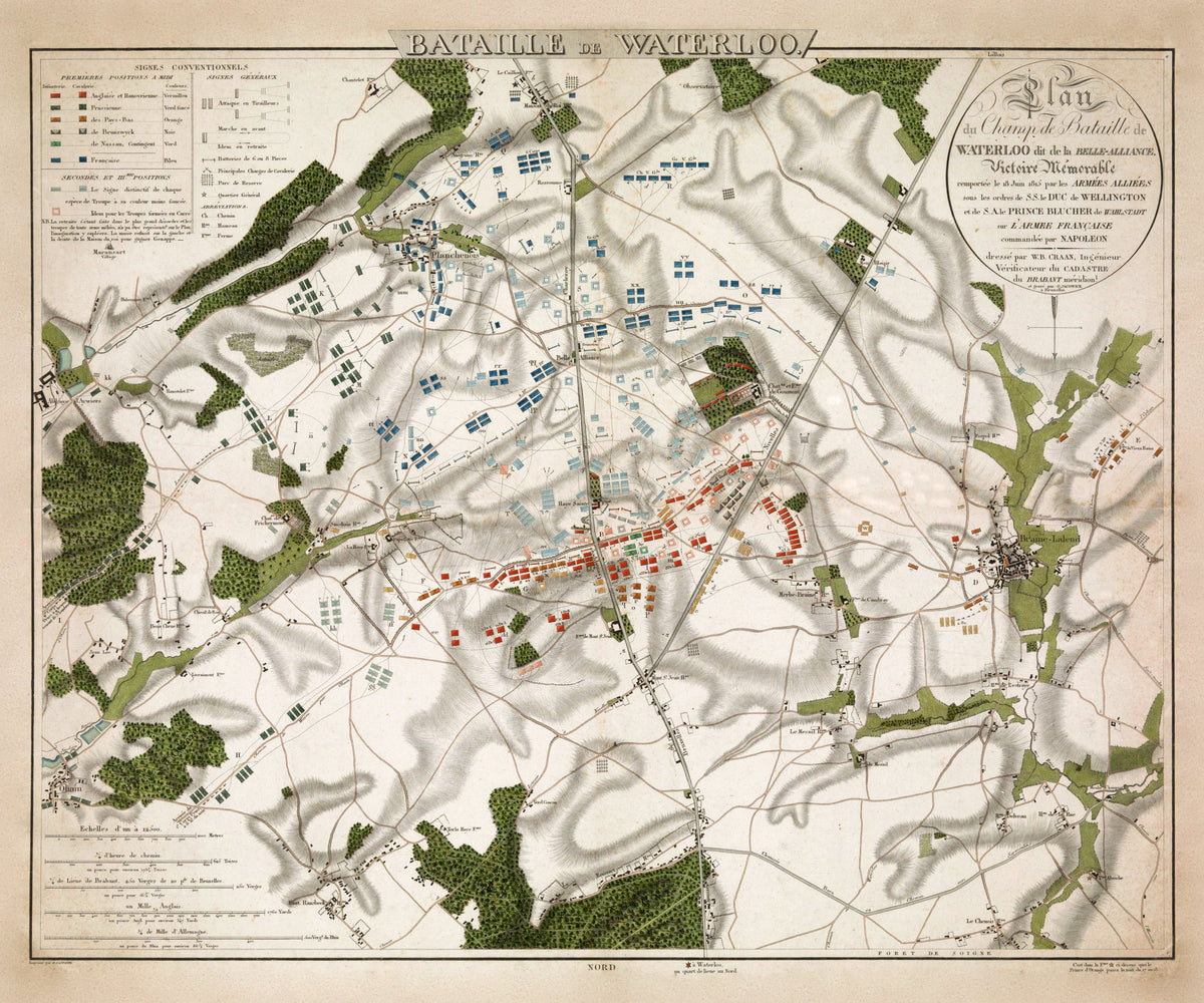
Plan du Champ de Bataille de Waterloo dit de la Belle-Alliance — W. B. Craan, engraved by G. Jacowick, Brussels, 1816.
The standard survey of the field, published the year after the battle, with each army's positions marked in hand-coloured blocks: British in vermilion, Prussian in dark green, Netherlands in orange.
Wellington drew up his army on the low ridge of Mont-Saint-Jean, across the Brussels road. The château of Hougoumont on his right held out to the end. The farm of La Haye Sainte in the centre fell late in the day, when its King's German Legion garrison ran out of ammunition. In the evening, as the Prussians broke through on the French right, the Imperial Guard was thrown back and the French army routed.
Willem Benjamin Craan, head of the land survey for the Dyle department, interviewed wounded French and allied officers brought into Brussels and Prussian generals. Published in September 1816, his plan was approved by Wellington and the Prince of Orange, and historians still rely on it. 'Belle-Alliance', after an inn on the field, was the Prussians' name for the battle.
Original held by the Rijksmuseum, Amsterdam. Restored by Limner from the museum's scan; nothing redrawn.