



About this print
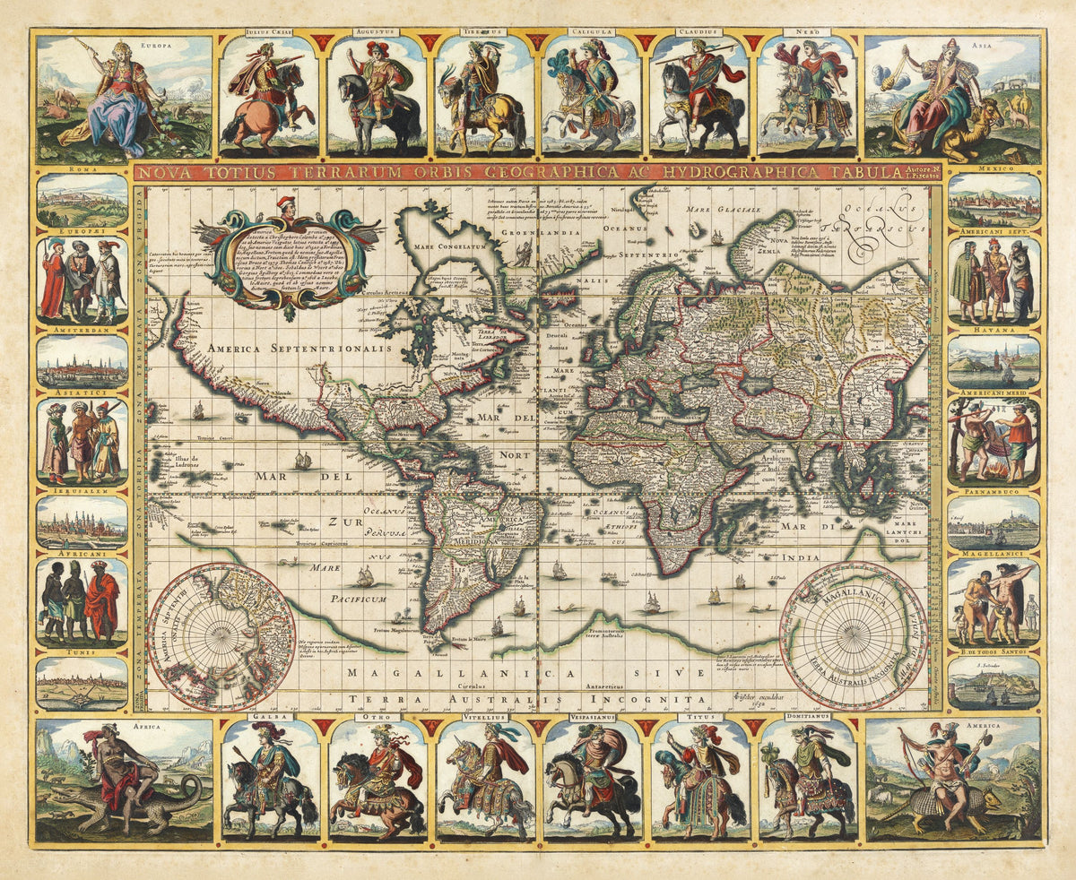
Nova Totius Terrarum Orbis Tabula — Claes Jansz Visscher, Amsterdam, 1652.
A richly coloured world map with the four continents personified in the corners and the heavens between the hemispheres. Around the map ride the twelve Caesars, Julius to Domitian, in armour on horseback, with city views from Rome to Havana and the peoples of each continent down the sides.
Claes Jansz Visscher (1586/87–1652) founded the family map business on Amsterdam's Kalverstraat. He often published under the Latin form of his name, Piscator, with a small fisherman as his mark, and etched more than 200 plates. This map still joins Marco Polo's 'Beach' to Magallanica, the imagined southern continent, a decade after Tasman had shown that Australia stood apart from any such land.
It was published in 1652, the year of Visscher's death, and the State Library of New South Wales suggests it may have been engraved by Pieter Goos. The plate outlived its maker: Yale's copy is bound in a Visscher Atlas Minor of about 1716. It is number 350 in Shirley's standard list of printed world maps.
Original held by the State Library of New South Wales. Restored by Limner from the library's scan; nothing redrawn.
Look closer
-

America on an armadillo
Europe's emblem for the New World was an animal it had never seen before the 1500s, so America rides an armadillo. The original sheet was heightened with gold on the weapons and clothing.
-

Twelve Roman emperors
The Twelve Caesars of Suetonius, Julius Caesar to Domitian, ride the top and bottom borders: the same twelve lives he wrote around AD 121, each horseman named.
-

Pernambuco
Pernambuco in Brazil earns a town view because it was Dutch: the Dutch West India Company held it from 1630 and lost it to Portugal in 1654, two years after this map.