


About this print
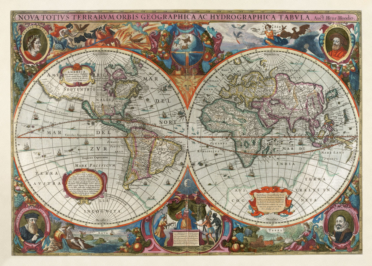
Nova Totius Terrarum Orbis Geographica ac Hydrographica Tabula — Henricus Hondius, Amsterdam, 1630 (this issue c. 1638).
A hand-coloured double-hemisphere world map with portraits of Caesar, Ptolemy, Mercator and Hondius in the corners and the four elements between the spheres.
Henricus Hondius (1597–1651) grew up in his father's Amsterdam map business. After Jodocus Hondius died in 1612 he helped run the firm, opened his own shop in 1621, and from about 1628 worked in partnership with his brother-in-law Jan Janssonius. By 1630 Dutch ships bound for the East Indies had charted stretches of Australia's west coast, starting with Dirk Hartog's landing in 1616, but the land's full shape was unknown.
In 1629 about 40 copperplates prepared by his late brother, Jodocus the younger, were sold to the family's chief rival, Willem Blaeu, and Henricus had engravers copy them. This world map, dated 1630 on the plate, comes from the Atlas Novus that Hondius and Janssonius published in Amsterdam in 1638.
Original held by the Norman B. Leventhal Map & Education Center, Boston Public Library. Restored by Limner from the library's scan; nothing redrawn.
Look closer
-

Tribute to Europe
The world order as an Amsterdam engraver saw it in 1638: Asia, America and Africa bring tribute to Europe on her throne.
-

Four corner portraits
A pedigree in four faces: Caesar and Ptolemy for ancient geography, then Mercator and Jodocus Hondius, who bought Mercator's atlas plates in 1604 and was the father of this map's maker, Henricus Hondius.