


About this print
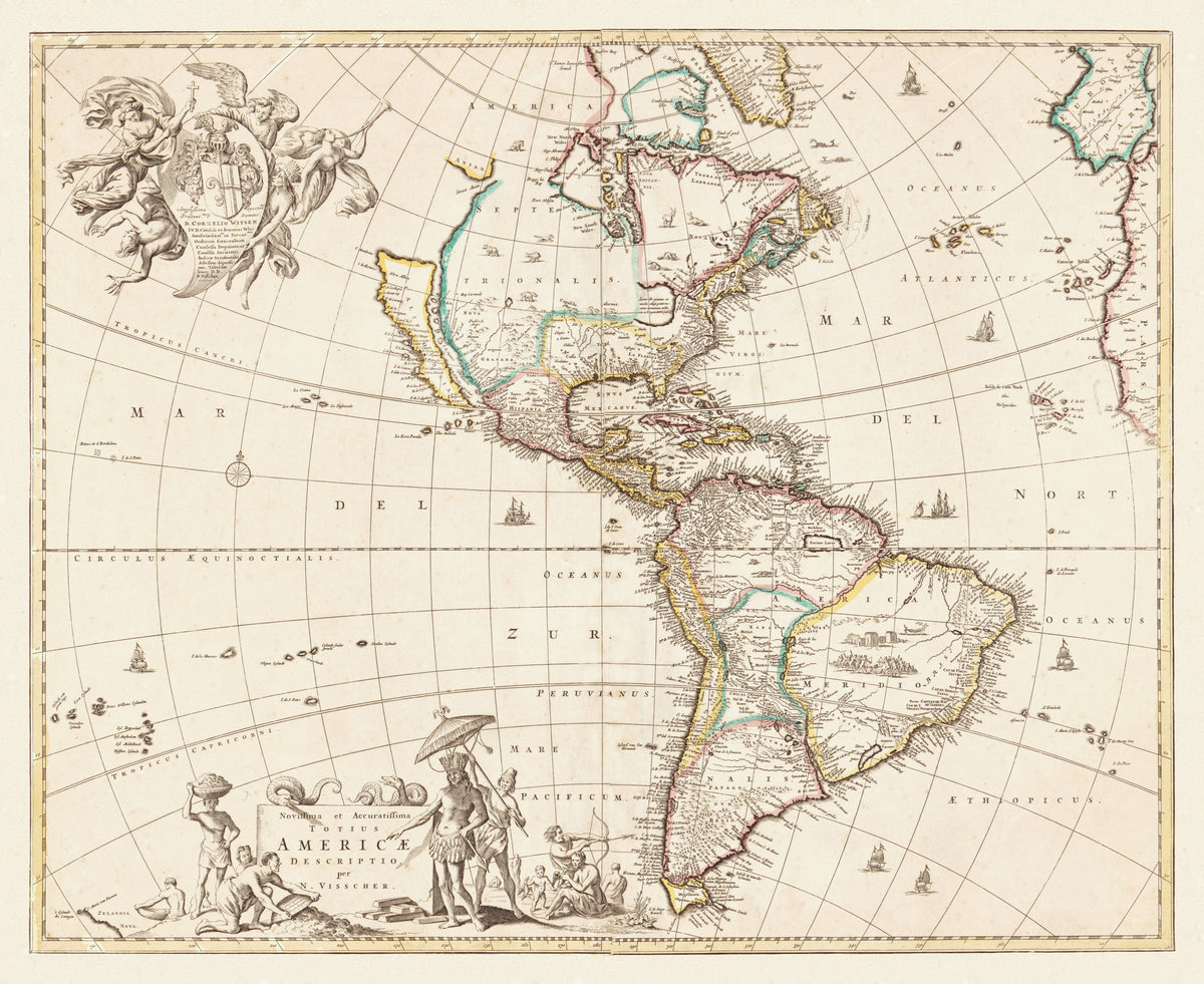
Novissima et Accuratissima Totius Americae Descriptio — Nicolaes Visscher, Amsterdam, about 1660.
A Dutch map of North and South America with light outline colour, sailing ships on every ocean and two crowded cartouches.
The title means "the newest and most accurate description of all America". Accurate is relative: California is drawn as a long island off the west coast, an error that ran through European maps for most of the seventeenth century, and the north-west of the continent simply stops where knowledge ran out.
The interior is filled with what the mapmaker had instead of surveys. Animals stand across North America. In the middle of Brazil a village is engraved, and just below it a battle between naked warriors armed with bows and clubs.
Nicolaes Visscher (1618–1679) ran the Amsterdam map house founded by his father Claes Janszoon Visscher. His map of the Americas was among the most copied of its time.
Original held by the Library of Congress, Geography and Map Division. Restored by Limner from the library's scan; nothing redrawn.
Look closer
-

Gold bars by the title
Around the title stand figures from the Americas: one in a feathered headdress and skirt under a parasol, a man carrying a basket on his head, a family with a bow, and at the front a miner bent over his work beside a neat stack of bars. Two snakes lie along the top of the title stone.
-

A dedication borne by angels
Top left, winged figures with trumpets carry a coat of arms and a dedication to Cornelis Witsen, a burgomaster of Amsterdam.
-

California, the island
Off the west coast, California floats free of the mainland, with its own gulf to the east.